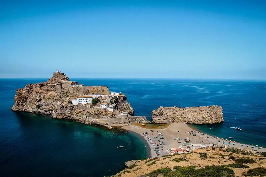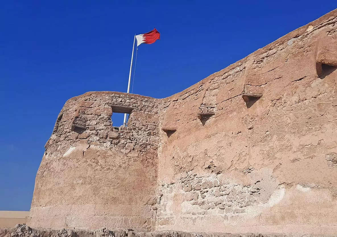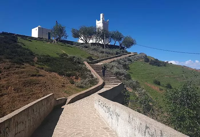
Peñón de Vélez de la Gomera with its narrow sandspit, separating between Spain and Morocco
photography by: Soufiane elkadaoui/ Wikimedia Commons

Despite the ever-increasing cooperation between modern-day nations, international borders still play a major role, separating different cultures, religions, and political entities. More often than not, this entirely imaginary and arbitrary line is the only thing that differentiates democracies from dictatorships, or different levels of economic prosperity. In some rare instances, borders are less than a kilometer long, each bearing an interesting story behind its mind-bogglingly short length.

By: Becca Osborne
Date: 15:22 12.08.22
Last Update: 11:26 07.01.25
Nestled in the midst of the Understen–Märket Passage that links the Gulf of Bothnia with the Baltic Sea, Märket Island is a 3.3-hectare rocky isle, devoid of any human population. Following the Treaty of Fredrikshamn in the early 19th century, this unassuming speck of land was evenly divided between Sweden and the Russian Empire, which ruled over Finland at that time.
As its Swedish name implies (Märket is translated as “the mark”), the uninhabited skerry has served as a reference point for dozens of vessels crossing the nearby waters at any given moment. To enhance the rock’s navigational merit, the Duchy of Finland, still a constituent part of the Russian Empire, erected a lighthouse on the island in 1885.
As the Finns built the structure on Märket’s highest point, they unintentionally ignored the international border that bisected the island, constructing the lighthouse on the Swedish side of the border. In 1981, a joint Finnish-Swedish committee resolved this unusual dispute by redrawing the border around the lighthouse. While Finland was given the lighthouse complex, Sweden received an equal portion of the island it relinquished to the former.
This mutual land exchange resulted in a rather bizarre situation where the newly formed border featured an “S” shape. Due to the island’s harsh weather conditions, the 506-meter-long convoluted border is marked with a dozen or so holes, drilled deep into the crag.
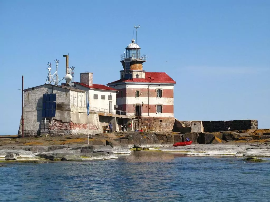
Märket Lighthouse, located on the island with which it shares its name
photography by: tt_koski/ Wikimedia Commons
At first glance, Baarle might seem like yet another village amid Northern Europe’s bucolic countryside. However, while this seemingly mundane town lies entirely within the Netherlands, it is in fact divided between the Dutch municipality of Baarle-Nassau and the Belgian municipality of Baarle-Hertog. To make things even more surreal, the village is pierced by more than 30 exclaves, the majority of which belong to Belgium.
The unruly border configuration originates from a series of medieval disputes, land swaps, and treaties between the Dukes of Brabant and the Lords of Breda, with the latter being the owners of the land that would later become a part of Belgium. Suffice to say that the existence of so many exclaves across a relatively small area resulted in some absurd situations, where a kitchen and a living room are located in two different countries despite being part of the same apartment.
Following the admission of both Belgium and the Netherlands into the EU and the Schengen Zone, much of the border mess is now a thing of the past. Interestingly, though, it wasn’t until 1995 that the two countries finally resolved their territorial dispute over Baarle, when the former no man’s land of De Wit Hagen was officially integrated into Belgium. Sharing a 206-meter-long border with the Netherlands, the insignificant exclave spans across 2,632 square meters of farmland, making it the smallest among Baarle’s enclaves.
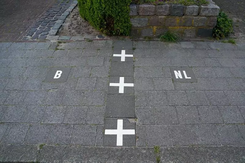
A pavement straddles the Belgian-Dutch border in Baarle
photography by: iamdanw/ Flickr
Throughout most of its history, the island nation of Bahrain didn’t share a border with any country for obvious reasons. That is, until 1986, when the King Fahd Causeway was inaugurated, linking Bahrain with the Kingdom of Saudi Arabia by a 25-kilometer highway across the Persian Gulf.
The grand-scale project also included the formation of a 2.5-kilometer-long artificial island, created from dredged sand and rock about halfway along the route. Aptly named Passport Island, this 88-hectare sandy isle is home to both countries’ border stations, as well as a pair of coast guard facilities, mosques, McDonald’s eateries, and ultra-modern observation towers, each of which has a restaurant at its top.
Also known as Middle Island, the artificial land formation consists of two individual islets connected by an incredibly narrow isthmus, where the actual 200-meter-long border runs.
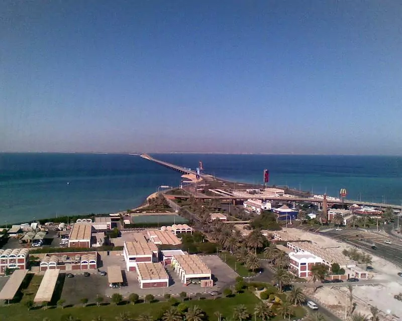
The Saudi portion of Passport Island as seen from the observation tower
photography by: Peter Dowley/ Flickr
If you look at a map of southern Africa, it might seem as if Namibia, Zimbabwe, Zambia, and Botswana share the world’s only international quadripoint. Nonetheless, a closer glance reveals that the supposed quadripoint actually comprises two tripoints, separated by a ridiculously short sliver of territory across the Zambezi River.
The 157 meters between the two tripoints currently serve as the international border between Namibia and Zimbabwe. In 1970, Namibia and Zimbabwe were governed by the apartheid regime of South Africa and the Rhodesian white minority, respectively. As the two allied regimes sought to hinder any cross-border cooperation between Zambia and Botswana, already independent countries at that point, they both claimed that the quadripoint was a matter of truth. Using the quadripoint’s supposed existence as a pretext, the Rhodesian army attacked and sank a ferry that made its way across the Zambian-Botswana border.
Up until recently, the only way of crossing the 157-meter-long border between Zambia and Botswana was by a ferry service. In 2021, the two countries replaced the ferry with the brand-new Kazungula Bridge, straddling the confluence of the Zambezi and Chobe rivers. Named after the pair of border towns which share the same name, the Kazungula Bridge was purposely curved so it wouldn’t encroach on either Namibian or Zimbabwean territories, passing directly through the world’s second-shortest border.

The pseudo quadripoint, few years before the Kazungula Bridge was built
photography by: Brian McMorrow and Julieta39 / Wikimedia Commons
For most of its history, Peñón de Vélez de la Gomera was an unassuming rocky isle off the Moroccan coast. During the early 16th century, the island was used as a refuge and a base of operations by groups of local pirates who regularly attacked Spanish vessels across the Mediterranean Sea. To put an end to the constant corsair raids, a Spanish naval brigade led by Pedro Navarro captured the island in 1508.
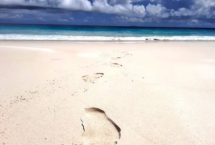
In the decades that followed, the island changed hands a couple of times until the Spaniards finally retook it in 1564, controlling this minuscule crag ever since. In 1930, a 7.0-magnitude earthquake trembled the area, moving the Iberian and African plates against each other. The massive quake was so strong that the ensuing deposition of sand formed a narrow 85-meter-long isthmus that linked Peñón with the Moroccan mainland, making it a de facto peninsula.
The then newly formed tombolo created some unintended consequences, as now Morocco and Spain shared a new 80-meter-wide border, recognized as the world’s shortest international border. While the skerry has lost all of its once-strategic importance, it is still claimed by both Morocco and Spain, while the latter keeps a military base at its confines, inhabited solely by soldiers.
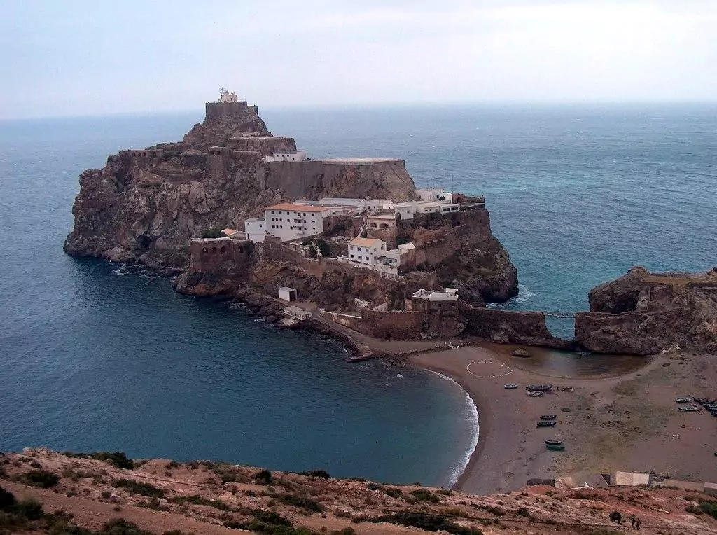
The sandy 80-meter-wide isthmus, officially known as the world's shortest border
photography by: Ignacio Gavira/ Wikimedia Commons